
I love finding mineral specimens that register on my Geiger counter. I have specimens from around the world that make my counter sing, like bright green needles of Cuprosklowdoskite or the rich bright yellows of a Carnotite from Colorado. There is nothing, however, like going out and finding your own radioactive rock in the wild.
Radioactivity is all around us. For example, some rock hounds—amateur geologists—are unaware that the smoky coloration of quartz is caused by ambient radioactivity in the granite from which it is collected. Without this natural source of radioactivity in the granite, the quartz would come out clear. Because of this, many deposits of sandstone quartz are clear. Some of these deposits, though, make good candidates for irradiating and turning smoky; they might have been naturally smoky when pulled out of the ground, if there was a nearby source of radiation. Granite often has bits of radioactive minerals inside, which in turn works with the quartz and renders it smoky.
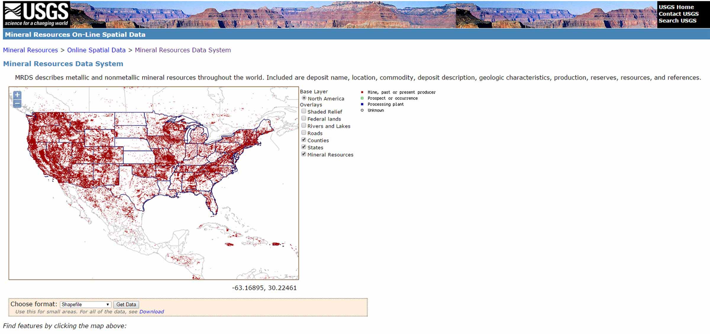
Back in the 1950s, the Uranium Boom took place all across America. Prospectors, armed with Geiger counters, looked for their very own deposit that could lead to mineral riches. Because of their search, we have tons of data to sift through on our search for radioactive in the wild. One of the best tools for locating deposits of radioactive minerals is MRDS (Mineral Resource Data System), a service provided by the USGS (U.S. Geological Survey), which shows a rich database of mineral deposits across the world.
To use this service, visit this page and select your map to use. Once your map is loaded, select your roads and map outlines and zoom into your area of interest. Each box represents a claim, though sometimes the claim is now void and not open to prospecting. This is one thing you will discover as you investigate and see the information for the mine. Along with this information, you will see the primary ore the claim was filed to mine. It never hurts to also check out the secondary ore, as uranium was often a secondary ore to copper deposits and pegmatites. It is common to see torbernite associated with copper secondary locations. Many of the gem pegmatites that produce tourmaline, topaz and beryl are rich with radioactive minerals like monazite and allanite (also called orthite).
Another helpful website to use in conjunction with MRDS is mindat.org. With mindat.org, you can search by region for mines that produce specific minerals. By comparing the notes from the data and photos on mindat.org to the mine locations on MRDS, you will be sure to find the nearest deposit with radioactive rocks. Armed with this data, you can add the notes from the MRDS data for the location. Then, you check it out on the satellite map, like Google Earth, check for property ownership and attempt to visit the location.
To showcase this information in action, I looked at the mineral locations listed on MRDS within 10 miles of my house; I found two. One is a pegmatite with Betafite crystals in the Cady Mountains, but it looks rather difficult to get to, deep in the rugged mountains. The other uranium deposit within 10 miles was a claim called Harvard Hill.
From my front porch I can look out into the near distance and see highway 15. Just beyond the highway is a black, volcanic appearing hillside labeled “Harvard Hill” on maps. As you trace the shorelines of the ancient Lake Mannix, you can see that Harvard Hill was an island, an outcropping of stone rising out of the flat, sandy background. All around the base of Harvard Hill lay agitated nodules showcase the ancient plants and palms, turned to stone. The fossilized remains are both colorful and plentiful. A few field collecting friends had told me about finding pale colored amethyst crystals on the hillside. After some minor prospecting, I did find one promising quartz crystal cluster in a wash, but I still have not figured out where they are coming from.
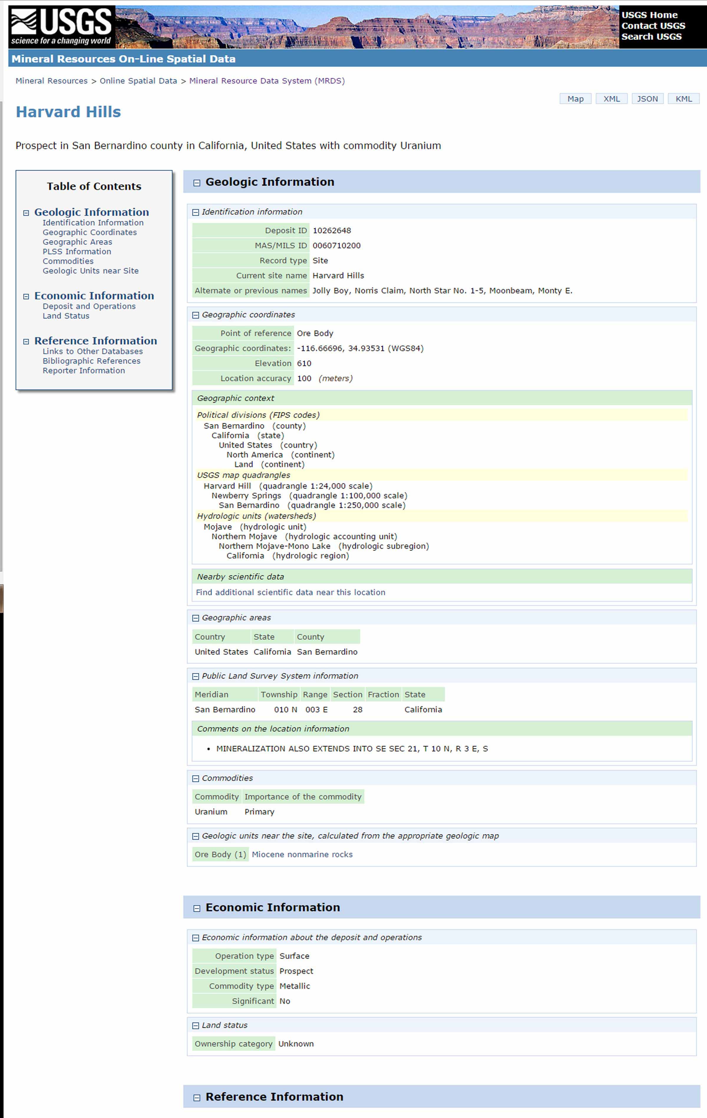
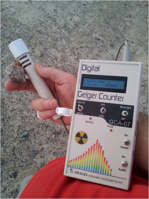
MRDS gives information about possible previous names for the claim, the elevation, coordinates, map quadrangles, rock type, and, the one I truly value, bibliographic references. Often you can find more detailed information in the listed references. For example, the listing for Harvard Hill Uranium deposit gives four references. I Google searched for the first example and found the PDF, for free, online. Not only does it give me more detailed information about the deposit, but it also lists several other deposits within 100 miles of my house. For Harvard Hill, the deposit is said to include a 25-foot trench and numerous pits. Furthermore, the publication shows me that the minerals found here, autunite and carnotite and found on fractures and bedding surfaces in the former lakebeds, deposited into the tuffaceous sandstone, clay, chert and limestone. With the information I grabbed my GCA-07W Geiger counter and headed off to Harvard Hill to see what I could find.
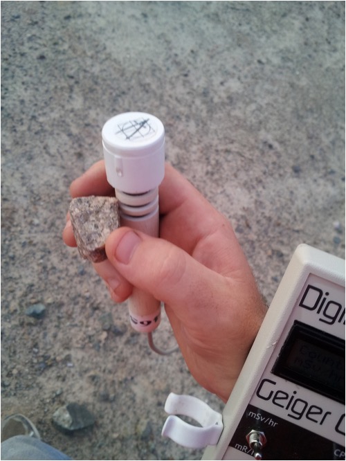
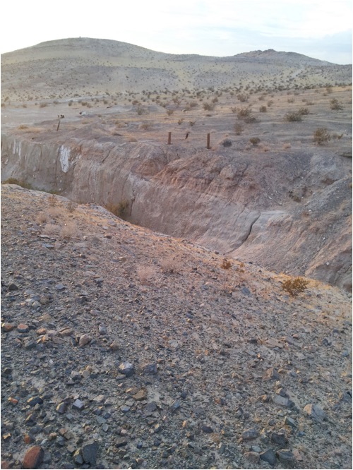
The large trench was visible on Google Earth, along with the dirt roads that would take me there, so locating the former mining claims was easy. After a short walk from where I parked my car, I located the 25-foot tall trench. Several large desert trees grew due to the lack of direct sunlight and protection from wind, which is uncommon out in the middle of the Mojave Desert. Scanning the walls of the trench, I could not locate a source of radiation from any layer of exposed rock. Visible scanning did not turn up any unusual colors or possible mineralization. Upon exiting the trench the wand detected something and the GCA-07W Geiger counter started to buzz. Right there, you could see visible grains of dark, radioactive mineralization in a course grained granite. I pictured an environment where the waters of Lake Mannix were eroding the granite outcropping, while depositing the uranium into the sand layers below. This would account for the discovery of yellow autunitic in the sandstone layers. Scanning the area, more samples triggered the counter, which was exciting to see. Without my Geiger counter, I would have had only my visual indicators to use. I gathered up my specimens and walked back to my car, happy to have some interesting reference material to examine and use to test my Geiger counter and show my friends.
Photos
- Harvard-U-Mineral-Collecting-01 – MRDS Location Screen
- “This is what MRDS can show us about the location, including further references to examine.”
- Harvard-U-Mineral-Collecting-02 – MRDS Intro Screen
- “From this screen you simply double click on the map to bring you closer into the area you want to inspect.”
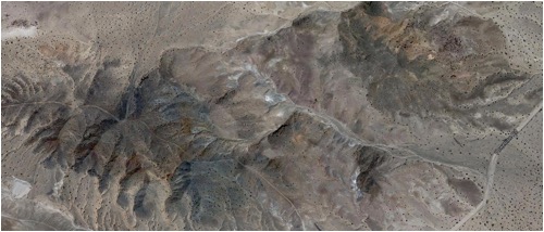
- Harvard-U-Mineral-Collecting-03 – Harvard Hill Uranium Mine on Google Maps
- “Examining the location on Google Earth gives you the ability to visit a location before arriving there.”
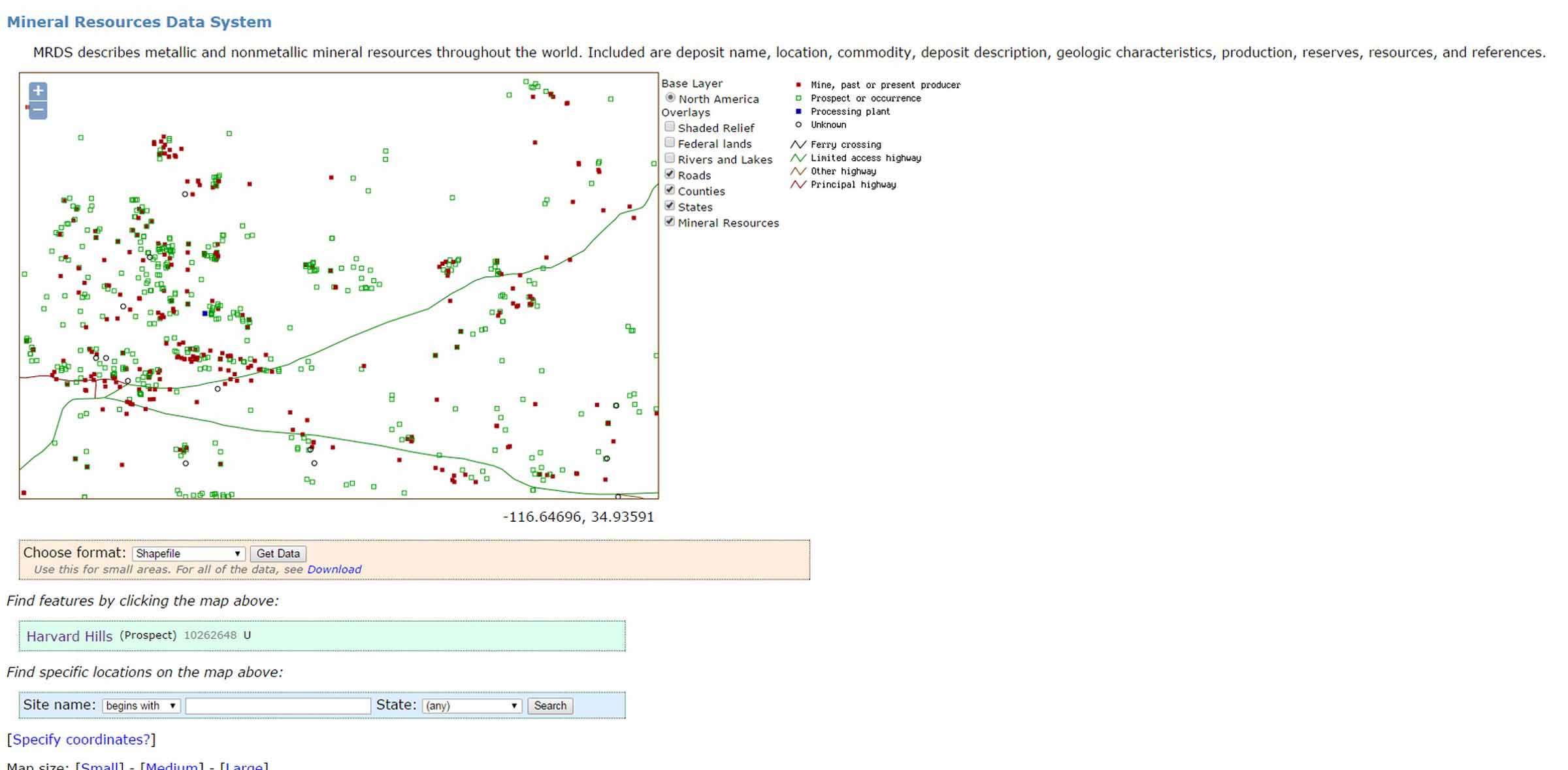
- Harvard-U-Mineral-Collecting-04 - Close up on my area on MRDS
- “As you click on squares across the map, you will see what ore products were mined. U for Uranium ore, if that is the primary ore, you are looking at one possible hot spot!”
- Harvard-U-Mineral-Collecting-05 – Examining granite with radioactive minerals
- Harvard-U-Mineral-Collecting-06 – 25 foot trench found at Harvard Hill – Excavated in search of uranium ore.
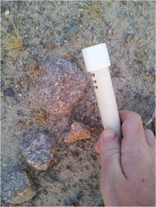
- Harvard-U-Mineral-Collecting-07 – Getting a response on the corse granite found at the deposit.
- Harvard-U-Mineral-Collecting-08 – Inspecting the ground for
feedback from the gieger counter.